DRONE MAPPING SERVICES
High-resolution Drone Mapping
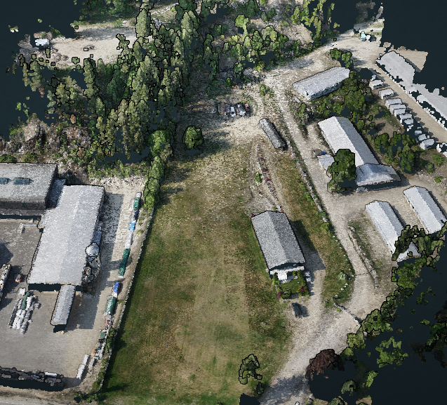
Many industries can benefit by using drone mapping services. Drone mapping is a fast, accurate, and cost-effective addition to a surveyor’s or a field technician’s toolbelt. Using drones for mapping large areas drastically reduces time spent in the field and therefore the total project cost. A mapping drone can take off and fly almost anywhere providing access to hard-to-reach places and rugged terrain. We operate the best mapping drone WingtraOne that allows for accurate repeatable high-resolution aerial data.
Private Property Mapping with Drones

Traditional surveying methods are time-consuming and expensive. Aerial mapping using drones allows us to generate a detailed map of your property which is then overlayed with cadastral data to get an understanding of the property’s layout and elevation profile. It is important to note that images collected via our drone are not legal surveys. However, they provide valuable information such as elevation contours and overall bird’s eye view to property owners allowing them to plan accordingly for their future projects.
What do I get?
Online access to high-resolution orthophoto (0.02m/pixel), 3D-point cloud, and digital elevation models.
17"-22" printable PDF of the property.
1-meter contours (<0.05 meters accuracy).
Only $399 for residential properties 50 acres and under.
***
Volume discounts.
***
Only $399 for residential properties 50 acres and under. *** Volume discounts. ***
-
![]()
Digital Elevation Models
-
![]()
3D Models and Point Clouds
-
![]()
GIS and Cadastral Data
-
![]()
High-resolution Orthomosaics
-
![]()
Plant Health Data
-
![]()
LiDAR
-
![better-ndvi]()
NDVI
-
![]()
Contours
-
![using drones for horticulture]()
Horticulture


Aerial Surveying with a Drone
If you're looking for high-quality aerial mapping services, look no further than Above Sensing Ltd. We are committed to providing accurate aerial data that can help you make informed decisions about your project. Contact us today to learn more about our drone aerial mapping services and how we can help you achieve your goals.