DATA ANALYTICS AND GIS
Drone and Geospatial Data Analytics Services
We specialize in utilizing cutting-edge technology for UAV surveying and mapping services to offer comprehensive geospatial data analytics solutions tailored to meet the unique needs of each client.
At Above Sensing Ltd., we understand the importance of accurate and reliable data for decision-making processes. Our team utilizes the latest tools and software to provide custom geospatial analytics, delivering precise data, mapping, and products that seamlessly integrate into existing CAD or GIS systems.
Our services encompass a wide range of applications, including but not limited to:
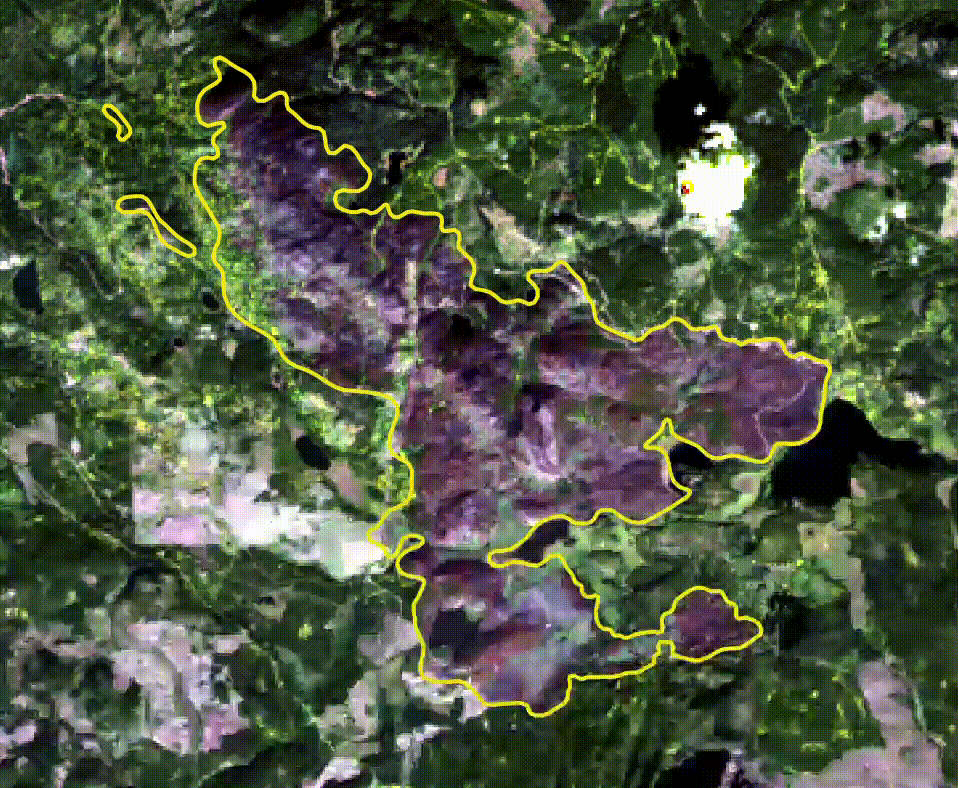
Statistical Process Control: Harnessing the power of geospatial analytics to optimize processes and ensure quality control
Change Detection: Identifying and analyzing changes in landscapes or structures over time for various industries
Machine Learning Models: Leveraging geospatial data to train machine learning models for predictive analysis and insights
Stockpile Information: Accurately measuring and managing stockpile volumes using drone-based data collection